GNSS PERFORMANCE |
| Channels | 1408 channels with iStar2.0 |
| GPS | L1C/A, L2C, L2P(Y), L5 |
| GLONASS | L1, L2, L3* |
| Galileo | E1, E5a, E5b, E6 |
| BeiDou | B1I, B2I, B3I, B1C, B2a, B2b |
| SBAS | L1, L2 |
| NavIC/ IRNSS | L5 |
| QZSS | L1C/A, L1C, L2C, L5 |
GNSS Accuracies |
| Real Time Kinematics (RTK) | H: 8 mm + 1 ppm RMS
V: 15 mm + 1 ppm RMS
Initialization time: <10 s
Initialization reliability: >99.9% |
| Post-processing kinematics (PPK) | H: 3 mm + 1 ppm RMS
V: 5 mm + 1 ppm RMS |
| PPP | Support B2b-PPP, E6B-HAS
H: 10 cm | V: 20 cm |
| High-precision static | H: 2.5 mm + 0.1 ppm RMS
V: 3.5 mm + 0.4 ppm RMS |
| Static and rapid static | H : 2.5 mm + 0.5 ppm RMS
V : 5 mm + 0.5 ppm RMS |
| Code differential | H : 0.4 m RMS | V : 0.8 m RMS |
| Autonomous | H : 1.5 m RMS | V : 2.5 m RMS |
| Visual stakeout | H : 8 mm + 1 ppm RMS
V : 15 mm + 1 ppm RMS |
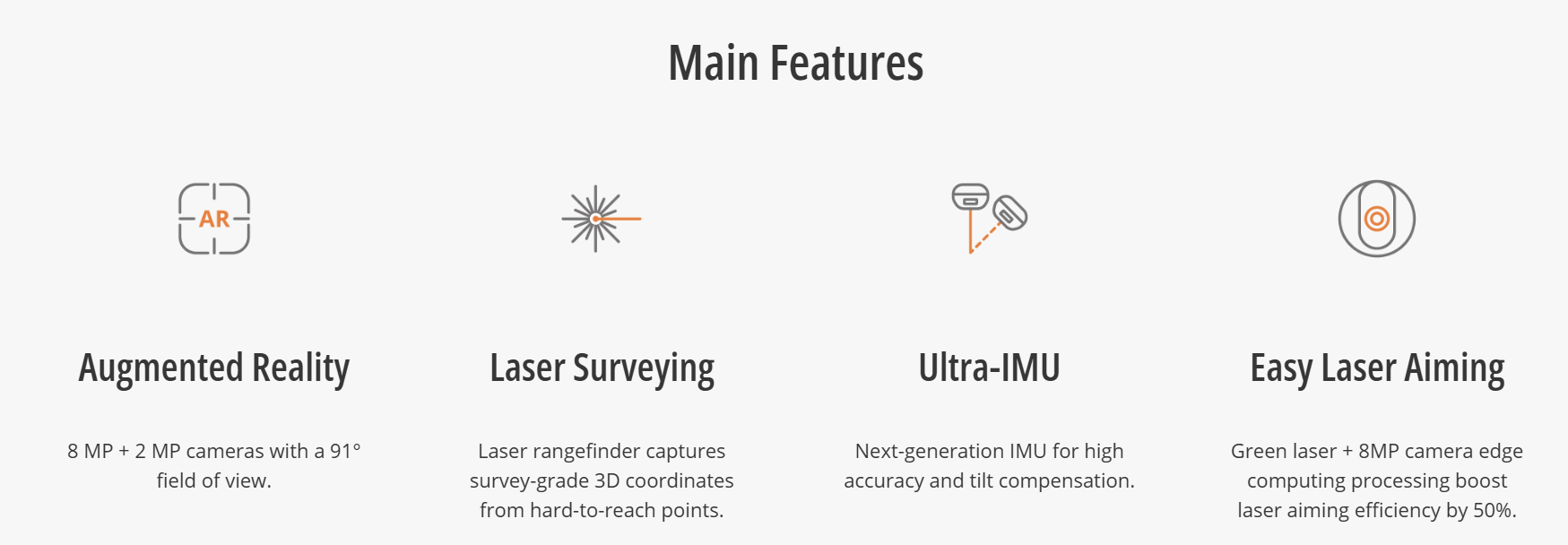
| Laser survey | 2 cm within range 5 m
3 cm within range 10m |
| Positioning rate | 1 Hz, 5 Hz and 10 Hz |
| Time to first fix | Cold start: < 45s |
| Hot start: < 10s |
| Signal re-acquisition: < 1s |
| IMU update rate | 200 Hz, AUTO-IMU |
| Till angle | 0-60° |
| RTK tilt-compensated | Additional horizontal pole-tilt
uncertainty typically less than 8 mm
+ 0.7 mm/° tilt down to 30° |
Environments |
| Temperature | Operating: -40°C to +65°C
(-40°F to +149°F) |
Storage: -40°C to +85°C
(-40°F to +185°F) |
| Humidity | 100% non-condensation |
| Ingress protection | IP68(6) (according to IEC 60529) |
| Drop | Survive a 2-meter pole-drop |
| Vibration | Compliant with ISO 9022-36-08 and
MIL-STD-810H |
Waterproof and breathable
membrane | Prevent water vapor from entering
under harsh environments |
Electrical |
| Power consumption | Typical 2.0 W |
| Quick charge | Full charge in 4.8 hours |
Operating time on
internal battery (7) | UHF/ 4G RTK Rover w/o camera: up
to 20h, Laser Survey: up to 16h
Visual Stakeout: up to 16h
UHF RTK Base: up to 12 h |
| External power input | 5 V / 2 A |
Hardware |
| Size (L x W x H) | Φ133 mm x 85 mm (Φ 5.24 in ×
3.35 in) |
| Weight | 800 g (1.76 lb) |
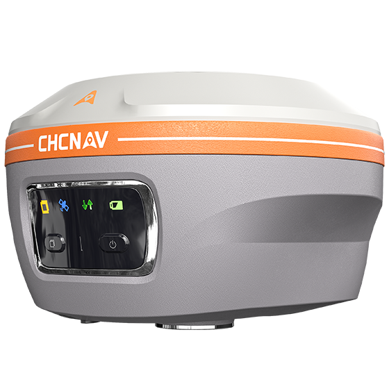
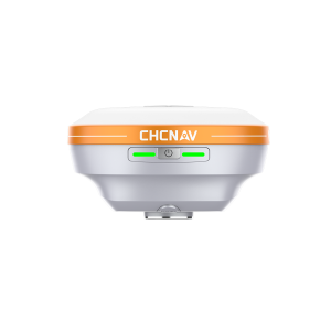
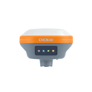
| Front panel | 4 LED, 2 physical buttons |
| Tilt Sensor | Calibration-free IMU for pole-tilt
compensation.
Immune to magnetic disturbances. |
| Laser sensor | Class 3R, Green (8) |
Cameras |
| Sensor pixels | Dual-camera, global shutter with 2 MP
& 8 MP. |
| Field of view | 91° |
| Video frame rate | 30fps (9) |
| Features | LandStar software, support
Visual Navigation, CAR AR Visual
Stakeout, Laser Survey. |
Communication |
| Wireless connection | NFC for device touch pairing |
| Wi-Fi | Wi-Fi 2.4G 802.11 b/g/n |
| Wi-Fi 5.8G 802.11ac |
| Bluetooth® | v4.2 backward compatible |
| Ports | 1 x USB Type-C port (external power,
data download, firmware update)
1 x UHF antenna port (SMA male) |
| Built-in UHF radio | Standard Internal Tx/Rx: 410 – 470 MHz
Transmit Power: 0.5 W, 1 W
Protocol: CHC, Transparent, TT450,
Satel
Link rate: 9600 bps to 19200 bps
Range: Typical 3 km, up to 8 km with
optimal conditions |
| Data formats | RTCM 2.x, RTCM 3.x, CMR input /
output
HCN, RINEX 2.11, 3.02
NMEA 0183 output
NTRIP Client, NTRIP Caster |
| Data storage | 8 GB high-speed memory |
Compliance with Laws and Regulations |
| International standards | IEC 62133-2:2017+A1, IEC 62368-
1:2014, UN Manual Section 38.3,
IC:32467-A2045, IEC60825-1-2007 |