FJD Trion Model Software
All-in-One Post-Processing and 3D Reconstruction for Surveying and Inspection
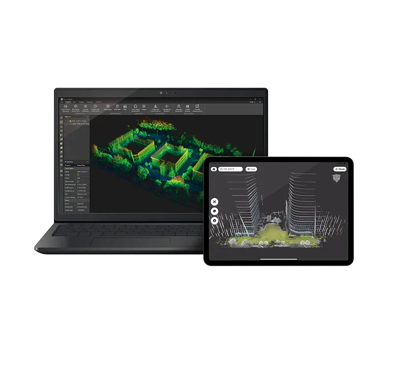
The FJD Trion Model Software is a powerful desktop application designed to process and visualize 3D data captured by FJDynamics’ Trion P1 3D mobile mapping system. Built for professionals in surveying, construction, asset inspection, and geospatial analysis, it transforms raw LiDAR and imagery data into detailed 3D models and accurate measurements.
Key Features:
-
Automatic Trajectory Calculation: Integrates GNSS and IMU data to generate a precise motion path for point cloud alignment.
-
One-Click Point Cloud Generation: Automatically fuses LiDAR scans and panoramic images to produce high-density, colorized point clouds.
-
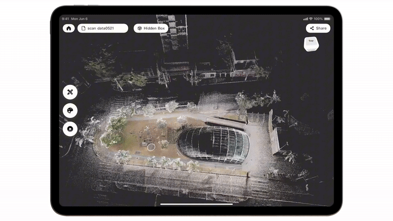
3D Model Visualization: Navigate and analyze rich 3D environments with real-time rendering of scans and high-resolution textures.
-
Measurement & Analysis Tools: Perform distance, area, and volume measurements directly within the model.
-
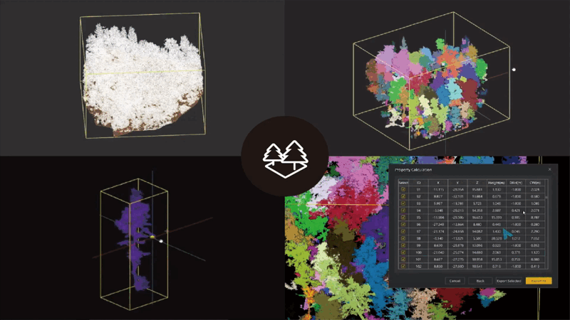
Point Cloud Editing: Filter, segment, classify, and optimize point clouds to remove noise and extract meaningful structures.
-
Seamless Export: Supports standard geospatial and CAD formats including .LAS, .PLY, .DXF, and .OBJ for integration with third-party software.
-
Report Generation: Create and export inspection or survey reports with annotated visuals and key project data.
Ideal For:
-
Topographic and infrastructure surveys
-
Utility and powerline inspections
-
Urban planning and digital twin creation
-
Roadway, tunnel, and bridge documentation
-
Construction progress tracking and QA
LICENSE ACTIVATION
Licenses are delivered between 12 to 24 hrs from the Payment day (Business hours)